If you poured water onto the ground and kept pouring and pouring, where would the water go?
Flowing further and further downhill the water would eventually find more water. It might be a pond or a stream, which itself flows downhill until it joins a larger body of water. Ultimately that water will reach the ocean, usually via a major river system.
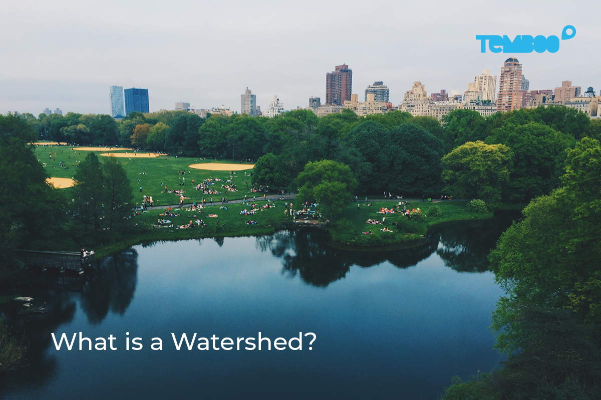
That whole drainage area where all the water flows into one place is a watershed. Understanding watersheds is crucial in caring for our waterways and water quality. They explain how actions throughout a watershed can affect the whole area and also how they compound the further downstream you go.
How Water Flows Through a Watershed
Now the above example presents a simplified view on how watersheds work. There are many variables that decide how much water flows into streams and rivers through a watershed. Here are some of the key factors that apply to every watershed.
Precipitation
The amount of precipitation that falls in a watershed is the main driver behind streamflows in the area. So how much rain and snow occurs within a watershed is very important. However, not all precipitation eventually flows out, and there are instances where streams continue to flow even without direct runoff from precipitation. An example of the latter would be a stream fed by a spring.
Infiltration
Not all precipitation makes it way to streams. Some water infiltrates the soil. That water may still make it to streams via gradual soil seepage downhill until it’s absorbed through the banks of a waterway.
But some of that water just stays in the soil, or may find its way deeper down into underground aquifers. In these cases that water is not contributing to the overall streamflow in the watershed.
How much precipitation infiltrates the ground is determined by:
- Soil composition: is it sandy, which is more absorbent, or more like clay, and therefore less absorbent?
- Saturation: How waterlogged is the ground already? Soggier soil absorbs less water than dryer soil.
- Land cover: What’s covering the ground? Trees and plants can help the soil absorb more water but also collect water on their leaves, preventing it from reaching the ground. Impervious surfaces like cement and asphalt prevent soil absorption and increase water runoff.
- Topography: Steeper slopes cause water to run off more quickly than flatter terrain, which provides more opportunities for rainfall to absorb into the ground.
Evaporation
A lot of rainfall returns to the atmosphere through evaporation. Temperature, humidity, wind, sunlight, pressure, and other environmental factors determine how much water goes back into the air.
Transpiration
The more vegetation there is in a watershed, the more water will be absorbed by the plant roots and ultimately released back into the atmosphere through their leaves. This process is called transpiration. The amount of water that is lost through it depends on the particulars of the area’s vegetation, as well as on the same environmental factors that affect evaporation.
Storage
The presence of any reservoirs and, of course, dams that block or limit streamflow also impact watersheds. In addition to restricting the amount of water that flows downstream, the reservoirs themselves also increase the amount of water that evaporates into the air.
Human Uses
People’s consumption of water will also affect how much flows through a watershed. Human uses include drinking water for homes and businesses but also significant quantities that are used in agriculture, manufacturing, and mining. In some cases so much water is diverted for human use that downstream bodies of water dry up.
Watershed Boundaries

Once you trace where all the water in a river system can come from, you can start to draw boundaries around watersheds. These are are called divides or ridgelines—elevated terrain where on one side the water will flow into one river system and on the other side will flow into a different system.
After tracing all the water back to its various sources, one can see how large watersheds can be. Here are three of the largest ones in the world.
The Amazon River Watershed

The Amazon River’s basin or watershed is the largest in the world by far, totaling roughly 7 million square kilometers.
While the Nile was long thought to be the longest river, research by NASA’s Shuttle Radar Topography Mission has shown the farthest source of the river to be somewhere on Mount Mismi, making the Amazon roughly 6,800 kilometers long.
The Mississippi River Watershed

The Mississippi River’s watershed covers nearly 40% of the landmass of the continental United States and includes numerous tributaries and smaller river systems. This large, navigable river system provides passage and routes that helped populate much of the interior of the United States.
The Mississippi watershed support a huge amount of the United States agriculture. This also means that all the fertilizer runoff from all those farms is flowing through the system down to its exit point into the Gulf of Mexico.
The Nile River Watershed

The Nile’s watershed includes a lot of arid land yet still supports over 160 million people. It also crosses through many countries, making the use and diversion of its waters a source of international dispute.
Even though the White Nile is fed by the large Lake Victoria, it’s the Blue Nile that contributes 86% of the Nile’s flow.
Watershed Ecology
Knowing about a local area’s watershed is critically important for understanding the ecology of the region.
In the same way that watersheds tell us how water accumulates and ultimately forms lakes and rivers, they also show how pollution can build up in a watershed. What seem like small amounts of pollution runoff (like oil from foods or fertilizer from farms) upstream can ultimately become very large, harmful amounts downstream.
Improving a body of water’s ecology is next to impossible without an understanding of its watershed. Otherwise, you can’t know where all the water and pollutants are coming from.
This also highlights the complications that arise when watersheds span multiple countries or other political subdivisions. It takes planning and coordination across the entire watershed in order to address its problems.
Sewersheds

Especially important for anyone living in built up areas are sewersheds.
The concept is very similar to a watershed. A sewershed indicates the entire area where water that enters the sewers all flows to the same source. In many cases sewersheds and watersheds overlap.
But sewers, with or without pumps, can also direct water where it wouldn’t go normally. In the image above you can see the natural watershed of Newtown Creek in green. However, this watershed is divided between two sewersheds, outlined in blue and red. The former sewershed directs water to the Newtown Creek Water Pollution Control Plant (WPCP), including a sizable amount of water from lower and eastern Manhattan across the East River.
New York City, like many older cities, has a combined sewer system that intakes both stormwater and wastewater. So when WPCPs are overwhelmed during rain events and trigger combined sewer overflows, the Newtown Creek WCPC is releasing some stormwater and rainwater into Newtown Creek that actually came from Manhattan.
When dealing with waterways and local ecology in populated places, the sewershed concept is more relevant because it accounts from human interventions in how water travels so that sources of pollution can be better identified.
Sewersheds also have some distinct features to keep in mind:
Impermeable Surfaces
Earlier I talked about soil infiltration and how it affects flows in watersheds. Sewersheds contain many more impervious surfaces, including cement and asphault. This disrupts the way precipitation would naturally move through a watershed.
What’s more, these impermeable surfaces generally require the construction of all sorts of infrastructure to handle rainfall.
Grey Infrastructure
Traditionally this infrastructure for handling rainfall in sewersheds includes drainage canals, the sewers themselves, retention pools & reservoirs, and all sorts of other “hard” infrastructure to redirect water.
Of course, all of this so-called grey infrastructure can direct water in ways that aren’t obvious if you don’t know how it all fits together. Now, many are becoming more critical of grey infrastructure because of its enormous costs and because it often seems to pass the problem of excess water from one place to another.
Green Infrastructure
To answer these concerns about grey infrastructure, many have been looking to green infrastructure. Green infrastructure can include green roofs, street trees, rain gardens, sponge parks, and the like.
In general, green infrastructure often tries to imitate the ways natural environments deal with stormwater, which typically involves plants to absorb water and slow down its flow.
Urban Ecology
In order to improve the environment and ecology anywhere, a thorough understanding of how its waterways work is a key component.
The watershed concept is invaluable for looking at river systems and waterways in the natural world. But the elaboration of that idea in the sewershed concept is especially critical since so many more people live in cities and other built up environments.
While the same efforts can be used to improve the ecology of watersheds and sewersheds, the sewershed concept can help improve the lives of many more people more directly.
If you’re interested in reducing the pollutants in your waterways, check out Riverkeeper’s recommendations and learn more about where your water comes from. You might be relying on a whole network and wide area of people to keep your own water clean.
You must be logged in to post a comment.